Rare Earth GIS. Land intelligence for the critical-minerals supply chain.
A full-stack geospatial platform that aggregates seven federal datasets into a single queryable map, scores every U.S. land parcel for rare-earth mineral acquisition across five weighted pillars, and tracks promising sites through a deal pipeline from prospect to closed. Built for mineral exploration companies, investment funds, and infrastructure developers running site-selection decisions on geological data that currently takes analysts weeks per parcel.
indexed
unified
per parcel score
score
A dozen federal agencies. Weeks of analyst time per site.
Rare earth elements are the critical minerals behind electric vehicles, defense systems, wind turbines, and consumer electronics. The United States holds significant unexplored REE deposits. But identifying which land parcels are worth pursuing requires synthesizing data from USGS, FEMA, USDA, the Census Bureau, EIA, and HIFLD into one analytical view.
Currently, that synthesis happens by hand. Analysts download shapefiles, reconcile coordinate systems, run proximity calculations in QGIS, cross-reference parcel ownership records, and end up with a spreadsheet that's stale the moment it's saved. Site selection takes weeks of senior-analyst time per region.
One queryable map. Every dataset. Every parcel scored.
Rare Earth GIS replaces the manual research loop with a live, queryable map. Seven federal datasets are pre-ingested into a single PostGIS schema with normalized geometries and spatial indexes. The frontend renders only the features inside the current viewport. Bounding-box queries hit PostGIS GiST indexes and stream GeoJSON through a debounced fetch loop, so panning the country stays smooth even with 145K mineral deposits and 363K flood zones loaded.
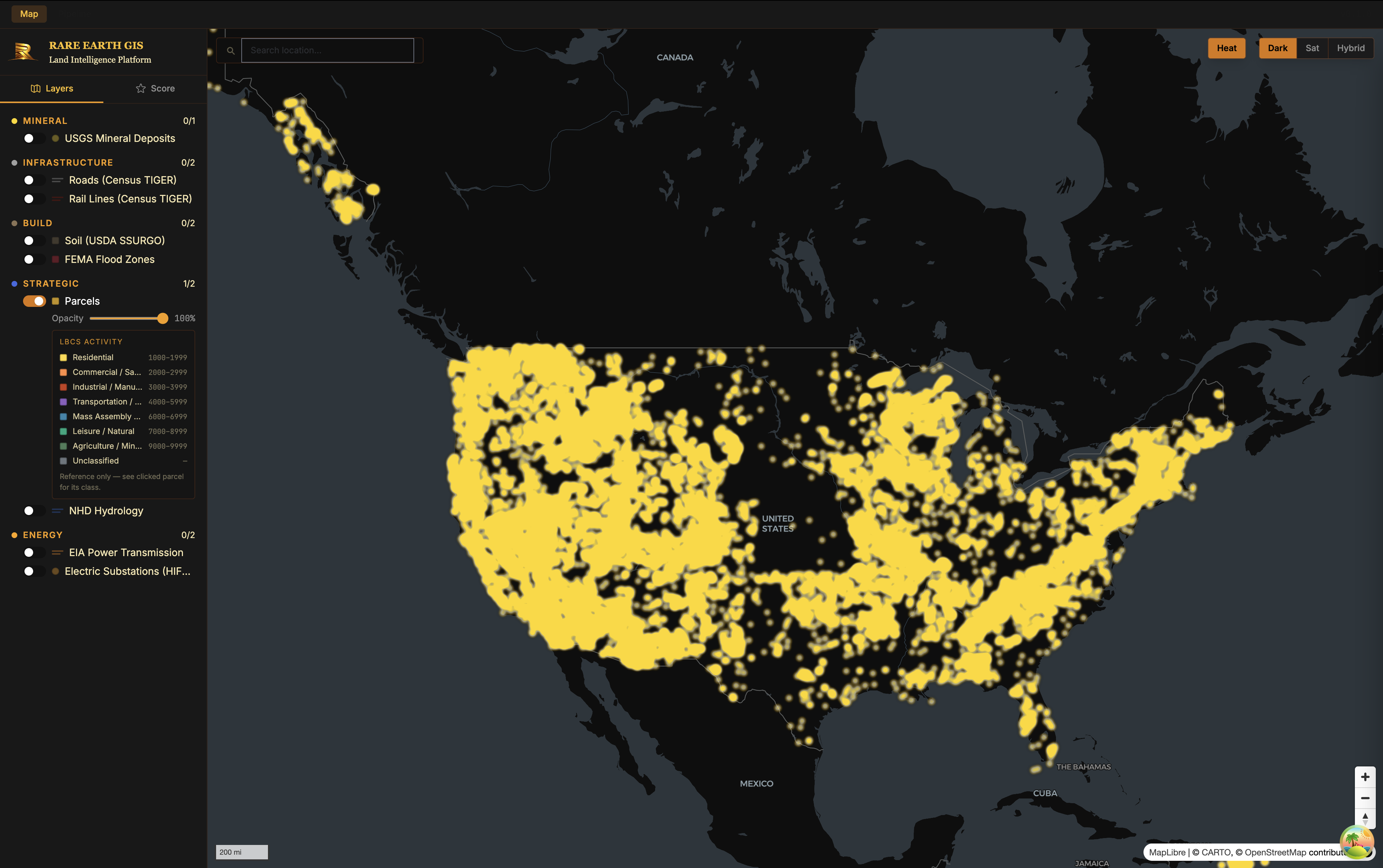
National view to Dallas, click a parcel, real enrichment returned live. No audio.
Multi-layer discovery
USGS deposits, HIFLD power lines, FEMA flood zones, Census TIGER rail and roads, NHD hydrology, USDA soil. Every layer toggleable, every layer rendered at viewport scope, every layer clusterable at low zoom.
Click-to-enrich parcels
Clicking any parcel opens a panel with APN, owner, address, lot size, building footprint, land-use code, zoning, assessed value, and FEMA flood risk. Cached in PostGIS so repeat lookups don't burn enrichment-API credits.
Five-pillar scoring
Every parcel gets a 0–100 composite score weighted across Mineral (35%), Infrastructure (20%), Build (15%), Strategic (15%), Energy (15%). Proximity signals decay exponentially; density signals log-normalize.
Deal pipeline
Qualified parcels move through prospect → due diligence → negotiation → under contract → closed. One click on the map opens a tracked deal pre-filled with parcel metadata.
Open federal data, at the scale that matters.
No third-party data licenses. Everything is ingested directly from the source agencies and refreshed on a documented cadence.
FastAPI on PostGIS. React on WebGL.
Production-grade Python on the backend, browser-native rendering on the frontend, containerized end-to-end. No SaaS dependencies beyond the data-enrichment API.
In active development. Public preview coming.
The platform runs end-to-end locally today: full data ingestion pipeline, scoring engine, parcel enrichment, and pipeline tracking. The remaining work before public preview is production deployment (PostGIS to Supabase, FastAPI to Railway, frontend to Cloudflare Pages under the HAWAMDA umbrella), auth integration, and a small set of UX polish items.
Interested in early access (as a user, a data partner, or an investor in the underlying critical-minerals thesis)? Get in touch.